![]() Hosted by StartLogic
Hosted by StartLogic
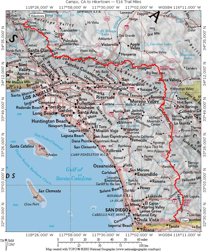
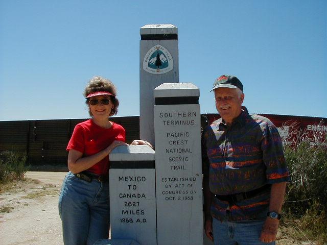
This website contains pictures taken during John and Pat Dickinson’s 516 mile Pacific Crest Trail Hiking Adventure of 2004. The Pacific Crest Trail (PCT) is a 2,627-mile national scenic trail that runs from
Overview
To start our trip, we drove our van from
This was a trip of extremes. The weather varied from extremely hot in the low desert to extremely cold nights in the high mountains. The trail elevation extremes were from 1200 to 9200 feet, with an extremely large amount of “undulation” (an overused term in the guide book) in each section of the trip. We encountered some of the most extremely dry conditions that we have ever seen on any of our trips. This was also the most physically demanding adventure to date. We saw many beautiful cactus flowers and scenic vistas and the extreme devastation that was done by wild fires. We saw beautiful stands of healthy timber and massive areas of destruction that is being done by bark beetles. And last but certainly not least, we met some of the most extremely nice and generous people that we have ever met. From fellow hikers to the “trail angels” that open up their homes for the hikers and cache water along the trail to make our hiking experience more enjoyable.
This trip also presented some interesting challenges in resupply. We elected to do most of our resupply from food packages that we had mailed to us periodically during the trip. We received a food package about every 5-7 days so we could minimize the amount of weight we had to carry in food. We dehydrated beef for jerky and fish, chicken and vegetables, etc to reduce their weight. We had the contents of all the boxes prepared before we left and would call back instructions from time to time to add or delete items as we learned as we went. Each box was then closed up and mailed out about two weeks before our arrival at the scheduled location. We want to thank Tom Rech for an outstanding job of getting our food packages, with the correct contents, to the correct locations at the appointed times.
We had prearranged to have our daughter Natalie meet us at Hikertown with our van at the end of our hike. She arrived on June 20, 2004 and we started on a two week road trip with Natalie. (Click here “Road Trip With Nat” for more details on the road trip.)
This was our most challenging and rewarding trip to date. It tested our ability to mentally and physically deal with the daily challenges of the trail, the weather, carrying our gear, food resupply and finding water. Just a few miles from one of the major population centers in the US (LA), it on the one-hand was unnerving that we could go for 3 days without seeing another person but on the other hand was extremely satisfying that we had those times to share the beautiful scenery and experience with just each other. We met some very interesting hikers on our trip. I find it so curious that there is such a wide diversity of people (age, income, origin, education, religion, politics) that are bound together by the single interest of hiking the PCT. I am still trying to comprehend the extraordinary generosity demonstrated by some of the Trail Angels that open their homes and lives to complete strangers. I reflect back frequently on the kindness and helpfulness of the many Trail Angels we met along the way. The scenery was beautiful, the satisfaction of handling the challenge and completing the planned distance, the opportunity to share this experience with Pat are all things that I will cherish but the single thing that made the greatest impression on me was the kindness and generosity we received from the people we met along the way.
An assortment of the pictures that we took on our hike are grouped in the Sections shown below. The PCT in
Section A: Mexican Border Near Campo, CA to Highway 79 near
Section B: Highway 79 near
Section C: Interstate 10 in San Gorgonio Pass to Interstate 15 near
Section D: Interstate 15 near
Section E:
Pat kept a hand written Diary of our trip. Each evening, Pat would record a summary of the day’s activities. After we returned home, the Diary was typed and can be found by clicking here.
We tried to keep in touch by calling in periodic Updates to Natalie and she would type them up and email them out. From time to time, we would have access to the internet from a trail angel’s home, a motel or a library. When we had access, we would email an Update to Natalie and she would forward that to the email list The Trip Updates can be accessed by clicking here.
We had our GPS with us on the trip. It is a Garmin Etrex Legend. Each evening we would record a waypoint at the place we camped or stayed for the evening. The set of waypoints for the trip can be found by clicking here.
If you wish to contact us you may do so using the contact information below. We enjoy answering any questions you may have about our trip. We also enjoy hearing about trips that you may have taken.
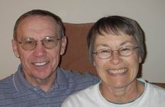
John and Pat Dickinson jrdpad@aol.com
Last revised: November 11, 2004