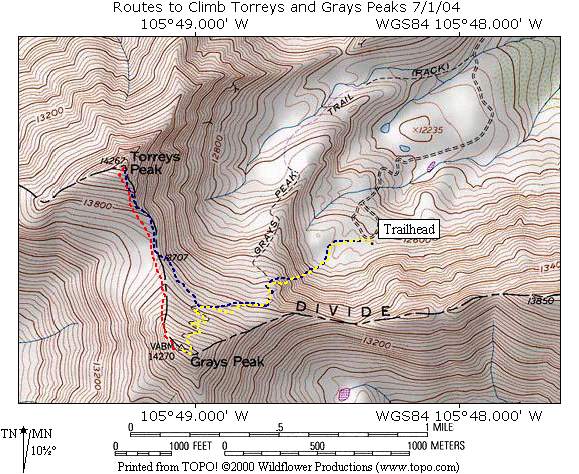
The map below shows the area of Torrey’s and Gray’s Peaks. From the Trailhead, there is a common approach to each peak. The “Blue Route” shows the path we took to ascend to Torrey’s Peak (14,267 feet). From there, we followed the “Red Route” along the Continental Divide down and across the saddle between the two peaks and up to Gray’s Peak (14,270 feet). Once at Gray’s peak, the “Yellow Route” shows the path of our descent back to the Trailhead. Click on the links below to see pictures specific to each item. Use your Browsers Back Button for navigation.
Approach Torrey’s Peak Gray’s Peak Descent Misc